
Roads are an important mode of transport in India. As of early 2025, India's National Highway (NH) network is over 1,46,000 km long, with the total road network exceeding 6.3 million km. The National Highways Authority of India (NHAI) reports that the length of National Highways has grown significantly, increasing by 60% in the decade leading up to 2024. This is the second-largest road network in the world, after the United States. The National highways in India are a network of trunk roads that is owned by the Ministry of Road Transport and Highways. It is constructed and managed by the National Highway Authority of India (NHAI), the National Highways and Infrastructure Development Corporation (NHIDCL), and the public works departments (PWD) of state governments.
The National Highways Authority of India (NHAI) is an autonomous agency of the Government of India, set up in 1988 and is responsible for the development, maintenance, and management of National Highways in India. Its role includes constructing and improving highways, providing facilities for users, collecting tolls, and conducting research to enhance the national road network.


(National Highway Authority of India) vide Office Memorandum dated 21-07-2016
The National Highways Development Project (NHDP) was a project of four laning of existing national highways and six laning of selected major national highways of India. The project was started in 1998 under the leadership of Prime Minister, Atal Bihari Vajpayee. National Highways account for only about 2% of the total length of roads, but carry about 40% of the total traffic across the length and breadth of the country. This project is managed by the National Highways Authority of India (NHAI) under the Ministry of Road, Transport and Highways.
NHAI (National Highway Authority of India) vide Office Memorandum dated 21-07-2016 has made the Mobile LiDAR technology mandatory in preparation of the Feasibility Study Report (FSR) and Detailed Project Report (DPR) for bringing more accuracy & speed in the execution of such highway projects.
“Prashant Advanced Survey LLP” is the first Land Surveying company in India to possess 2 numbers of ‘Leica Pegasus Two’ Mobile LiDAR Systems in the year 2016 and six numbers of ‘Leica Pegasus Two / Ultimate systems’ in 2025. We have the capacity to capture LiDAR data of highways for about 1,500 Kilometers per day using six instruments, with accuracy of about +/- 2 to 5 cm. We use this, State of the art, 3D Mobile LiDAR Technology for carrying out 3D LiDAR topographic survey of Expressway / Highways / Roads, Railways & Airports in India.
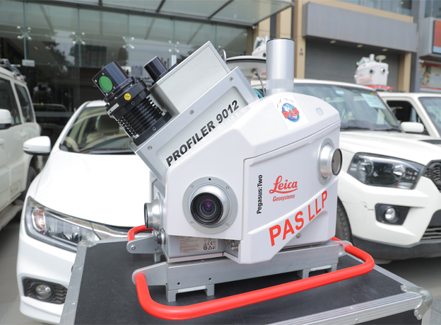
Our 3D Mobile LiDAR ‘Leica Pegasus Two’ system
We have successfully completed about 35,000 Km of Highway Surveys, about 3,000 Km of Railway surveys and 2 defence airports in India using the ‘Leica Pegasus Two’ Mobile LiDAR Survey instruments. Also executed 650 Km Highway No. 65 project in Saudi Arabia in the year 2023 using the mobile LiDAR technology.

Our 3D Mobile LiDAR ‘Leica Pegasus Two’ system mounted on SUV for Road survey
The ‘Leica Pegasus Two’ system gives a unique & complete Survey grade mobile mapping solution to our clients with high speed & accuracy. The system can be mounted on any four-wheeler vehicle & can capture high precise data upto +/- 2 cm for about 200 to 300 Km of Highways in one day, which would have taken at least a month using primitive Electronic Total Stations (ETS) method.
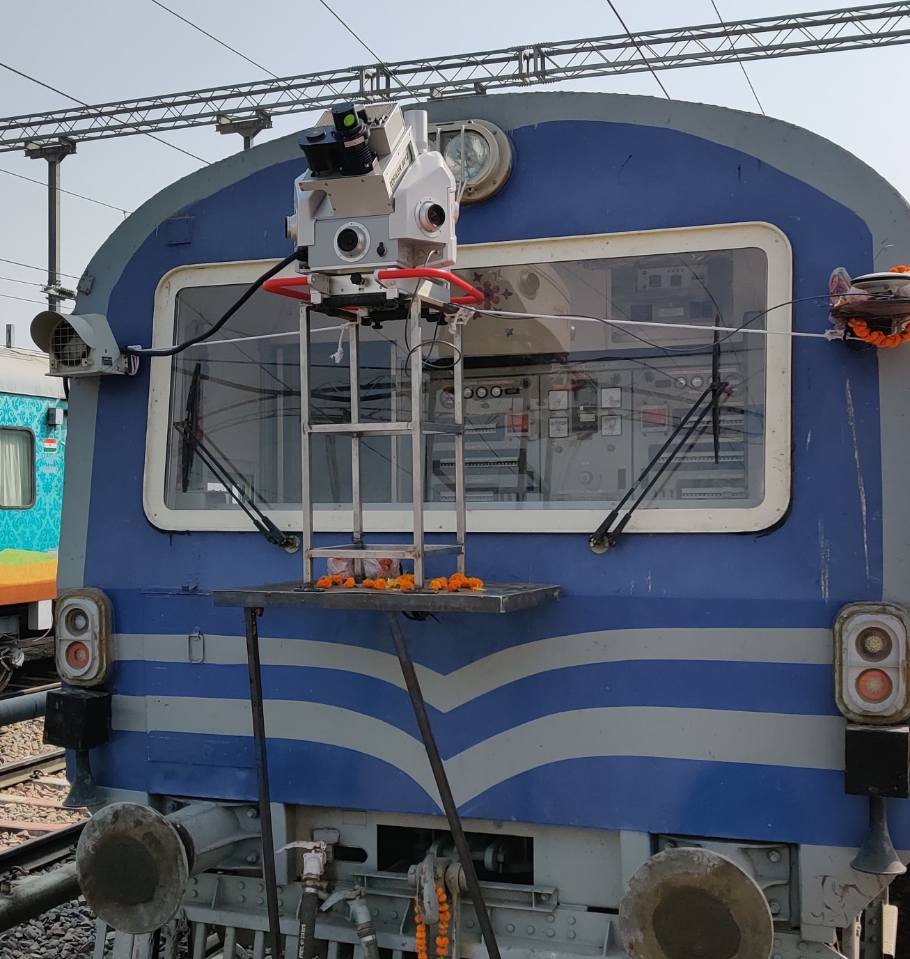
Our ‘Leica Pegasus Two’ Mobile LiDAR mounted on ‘Tower Wagon’ for Railway Survey

Our ‘Leica Pegasus Two’ Mobile LiDAR mounted on ‘Motorized Trolley’ for Railway Survey
The Leica ‘Pegasus Two’ mobile LiDAR System can capture :
- ‘3D Scan point cloud data’ in 360 degrees : (using Z+F 9012 profiler).
- ‘High Resolution photographs’ in all directions. (using CCD Cameras).
- ‘Trajectory file’ / position information, (using GNSS Receivers).
The Pegasus system captures dense 3D point cloud data with calibrated imagery and enables processing, visualization and mapping through user-friendly software platform “Way Point Inertial Explorer, Leica Pegasus Manager (Auto P) & Leica Map Factory Advanced & TopoDOT”. Further, after post processing & feature extraction of the 3D point cloud data, output in desired format like Autocad *.dwg or Arc GIS *.shp files can be obtained. The further deliveries also include the cross section in *.csv and *.dxf format of bare earth, DTM / TIN, Contours, 360 degrees panoramic views of the entire highway corridor.

‘3D Scan point cloud data’ for City road captured by using Mobile LiDAR ‘Leica Pegasus Two’:

Screen Shot of ‘Photographs’ & ‘3D Scan point cloud data’ in ‘Leica Map Factory’ software
Key points of LiDAR Data Capture using our Mobile LiDAR 'Leica Pegasus Two' :
- Mobile LiDAR Data can be collected with the speed of vehicle varying from 10 Km / hour (on city roads) up to 80 Km / hour (on Highways). Ideal vehicle speed maintained by us is usually 30 to 40 Km / hour on city roads and 40 to 50 Km / hour on Highways.
- Each run of Mobile LiDAR can easily capture about 150 m corridor (i.e. 75 m on either side of the run) with dense 3D point cloud data, 360 degrees panoramic view camera data and GNSS / IMU data. Multiple runs are usually required for capturing high quality 3D point cloud data on Highways and Expressways with median, grade separators and service roads.
- In one day, about 200 Km to 300 Km length Mobile LiDAR data can be easily collected by 'Leica Pegasus Two' on a two-lane highway with single run.
- The raw data collected on site is so dense (about 1 GB data collected for 1 Km length of highway) that it has to be downloaded into external hard disk and transported to the head office for further data processing and feature extraction, from the registered 3D point cloud data.
- LiDAR data processing and registration on 3D point cloud is done using 'Leica Pegasus Manager (Auto Process)', whereas the feature extraction of point, line and polygon features are done using multiple licenses of Leica Map factory software. Final delivery of 3D topographic plan can be made in Arc GIS shape files or Autocad *.Dwg files as per the requirements of the client.
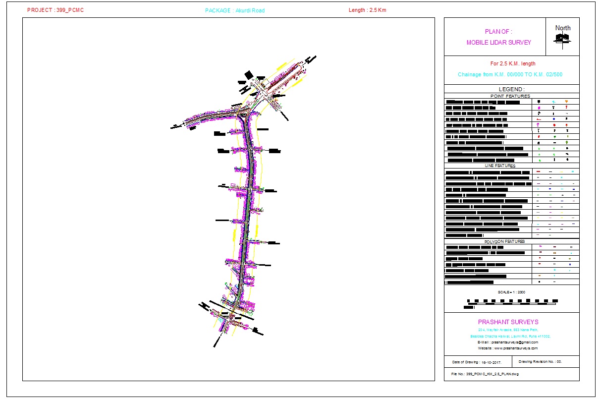
Sample 3D plan of highway corridor, generated from Mobile LiDAR Survey.
For some inaccessible areas like culvert invert levels, or bypasses where the four-wheeler vehicle cannot be driven, the Mobile LiDAR technology can be assisted by Backpack LiDAR, Drone based LiDAR, High resolution satellite images or our traditional DGPS RTK surveys to generate a complete data of the given corridor.
SURVEY GRADE MOBILE LIDAR INSTURMENTS ALONG WITH PROCESSING SOFTWARE OWNED BY M/s Prashant Advanced Survey LLP
| Sr. | Name of Mobile LiDAR Equipment | Make | Numbers |
|---|---|---|---|
| (Survey Grade, Mobile LiDAR / NSV) | |||
| 1) | Leica Pegasus Mobile Mapping System / (NSV), with Z+F profiler 9012 Laser Scanner, having 119 m range & Scan point density of 1 million points per second & having 6 CCD cameras & additional pavement camera for pavement analysis, cracks, distress & IRI. (Width of corridor practically covered with dense 3D point cloud data = 150 m) |
LEICA Geosystems, Pegasus Two / Ultimate Mobile Mapping System (MMS) | 6 |
| 2) | Waypoint Inertial Explorer (for trajectory), Leica Pegasus Manager / Auto P (for data pre-processing & preparing registered 3D point cloud data), Leica Map Factory Advanced : Arc GIS / Certainty 3D TopoDOT; (for data processing & feature extraction), 3D Reshaper {for classification, DEM / TIN} Certainty 3D TopoShare for online data visualization and download. Bentley OpenCities Map and Reality Modeling Worksuite for 3D mesh modeling. Arc GIS Desktop & AutoCAD (for drawings & delivery) |
LEICA Geosystems, Certainty 3D, Bentley, ESRI, Autodesk |
50 |
LiDAR Data Capture by ‘Leica Pegasus Two’ Mobile LiDAR System :