We would like to introduce ourselves, with dignity and pride, as 34 years old professional Land Surveying & Mapping company based in Pune, India, providing complete 3D Geospatial Solution to our clients with Land Surveying, Mapping & GIS requirements. We use the 'state of the art' advanced technology of Survey grade 3D Mobile LiDAR, Backpack LiDAR, UAV (Unmanned Aerial Vehicle) / Drone LiDAR Scanning, dual frequency DGPS / GNSS (Differential Global Positioning System / Global Navigation Satellite System), High Resolution Satellite images, Digital Twin & customized GIS solution. We offer our cost-effective quality services to Government, Semi Government, Private Organizations & Corporates all over the globe, with high speed and best in class accuracy.
‘Prashant Advanced Survey LLP’ has emerged as one of India’s most technologically progressive surveying and geospatial mapping enterprises. Rooted in a legacy that dates back over three decades, the organisation stands today as a trailblazer in high-precision Mobile LiDAR mapping, digital modeling, and advanced geospatial data solutions. Under the stewardship of Designated Partner Prashant S. Alatgi, the company has evolved into a symbol of innovation, reliability, and national-level impact.
The organisation’s journey began in 1991, when Mr. Shivanand Alatgi established “Prashant Surveys” after voluntarily retiring from the ‘Survey of India’. Initially equipped with basic plane table surveying and dumpy-level methods, the company soon redefined its trajectory. In 1998, it became the first private surveying firm in India to adopt the ‘Electronic Total Station’ (ETS) equipment, marking its transition into modern survey practices.
This pioneering spirit continued, leading to a defining moment in 2015 when the company acquired India’s first ‘Leica Pegasus Two’ Mobile LiDAR Survey Instrument. By 2016, it became the only private survey organisation in India to own multiple Mobile LiDAR units, setting new industry benchmarks in advanced, high-speed geospatial data acquisition.
In 2018, the firm expanded its operations with a dedicated entity— Prashant Advanced Survey LLP —focused exclusively on advanced LiDAR surveying and GIS mapping services, headed by the Designated partner Mr. Prashant S. Alatgi. By 2025, the organisation owns six numbers of ‘Leica Pegasus Two / Ultimate systems’, making it the first in India and second in the world to maintain such a vast and specialised Mobile LiDAR fleet. The firm has successfully completed about 35,000 Km of Highway Surveys, about 3,000 Km of Railway surveys and 2 defence airports in India using the ‘Leica Pegasus Two’ Mobile LiDAR Survey instruments. The firm has also executed 650 Km Highway No. 65 project in Saudi Arabia in the year 2023 using the mobile LiDAR technology.
Prashant S. Alatgi’s leadership plays a central role in the company’s evolution. A civil engineering graduate, postgraduate topper, and a final-year Ph.D. research scholar in advanced surveying, he brings over 26 years of professional expertise. His contributions include speaking at 34 international conferences and holding prestigious memberships, such as Chartered Engineer and Fellow of the Institution of Engineers (India).
Mr. Prashant S. Alatgi has about 26 years of field experience & expertise in use of modern electronic Land Survey instruments & technologies like Survey grade 3D Mobile LiDAR, Backpack LiDAR, UAV (Unmanned Aerial Vehicle) / Drone LiDAR Scanning, dual frequency Differential Global Positioning System (DGPS/GNSS), Electronic Total Stations (ETS), High Resolution Satellite images, LiDAR data processing, Digital Twin & customized GIS solution. Mr. Prashant S. Alatgi has also been certified by Government of India, Department of Space, ISRO, NRSC, Hyderabad, India where he was awarded First Class with Distinction on 5th March 2010 in the field of “Remote Sensing & GIS – Technology & Applications”. He is a Certified Subsurface Utility Engineer (SUE) by Engineering Council of India & IndSTT and a Speaker in 34 International Conferences worldwide on Advanced Surveying technologies. He is a life member of various organization viz. Institute of Engineers, Indian Road Congress (IRC), Indian Society of Remote Sensing (ISRS), Indian National Cartographic Association (INCA), Indian Society of Geomatics (ISG), Surveying & Mapping Association (SAMA) to name a few.
Our site execution team consists of highly skilled, experienced engineers, surveyors and professionals, along with our expert ‘3D Mobile LiDAR survey’ data collection team, headed by our technical consultants mainly retired from Survey of India, with more than 40+ years of experience.
We own a wide variety of Advanced Land Surveying & Mapping Instruments, including six numbers of ‘Leica Pegasus Two / Ultimate’ 3D Mobile LiDAR System, three numbers of Backpack LiDAR systems / Drone based LiDAR systems, Lecia GS14 RTK & TRIMBLE R8 dual frequency DGPS receivers, DGCA type approved PPK UAV / Drone ‘Lookout VTOL’ from TAS, Bangalore, Lecia 1200 series reflector-less Total Stations, Leica Sprinter Digital Levels, Distomats to name a few.
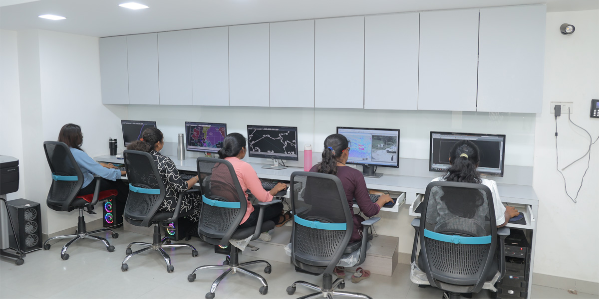
We have a fully developed & integrated Survey data processing GIS team, working with Licensed Waypoint Inertial Explorer, Leica Pegasus Manager (Auto P), Leica Map Factory for Arc GIS, Topodot / Toposhare, Bentely open cities map & Reality Modelling worksuite, Pix4D, 3D Reshaper advanced software’s, using higher end Workstations capable of processing huge 3D point cloud mobile LiDAR data & photographs. Our computer division also consists of several higher end Intel desktop processors / Laptops, HP Design jet T830 large format coloured MFP (multifunction plotter, scanner & copier).
We follow the working method and accuracy as per Survey of India norms. Being an industry expert, we also provide special training programs on ‘Mobile LiDAR, Backpack LiDAR, UAV / Drone LiDAR, DGPS, GIS & the implementation of latest technology for providing complete Geospatial Solutions’ for the top class Government officers from various departments including NHAI, BRO, IRICEN Pune, Maharashtra; PWD National Highways and State Highways, Karnataka & various Engineering Colleges, in & around Pune, India.