
Backpack LiDAR survey is the most advanced method of indoor & outdoor Surveying, done using a wearable device, combining state-of-the-art Laser scanning, 360 degrees Panoramic images, Differential Global Positioning System (DGPS), Simultaneous Localization And Mapping (SLAM) technologies, to deliver high precise colourised 3D point cloud data along with camera data, which can be digitised to prepare 3D As-built CAD map or BIM plan of any site (viz. land parcels, gardens, accident spots, factories, plants, buildings, townships, campus, slums, shopping complexes, malls, underground stations, basements, tunnels, bridges etc.) which is under construction or fully built.

Images of Backpack LiDAR Survey in various site conditions (outdoors & indoors)
Advantages of the Backpack LiDAR Survey, as compared to the ETS & DGPS :
- Most Advanced Geospatial technology which uses SOI CORS DGPS coordinates.
- Extremely fast & accurate as compared to the Electronic Total Station (ETS / DGPS).
- 3D Laser scanning, along with 360 degrees HD panoramic camera data of the site.
- Uses the SLAM technology, hence can be efficiently used in GPS denied areas.
- Can be used in various locations; outdoors, indoors, tunnels, underground stations etc.
- Fully automatic data capture by only one trained surveyor, walking with the backpack.
- Digital outputs with colourised 3D point cloud data in *.LAS format with images & videos.
- Delivery of 3D vectorised data in AutoCAD *.dwg files with DEM / DTM, Contours & BIM.
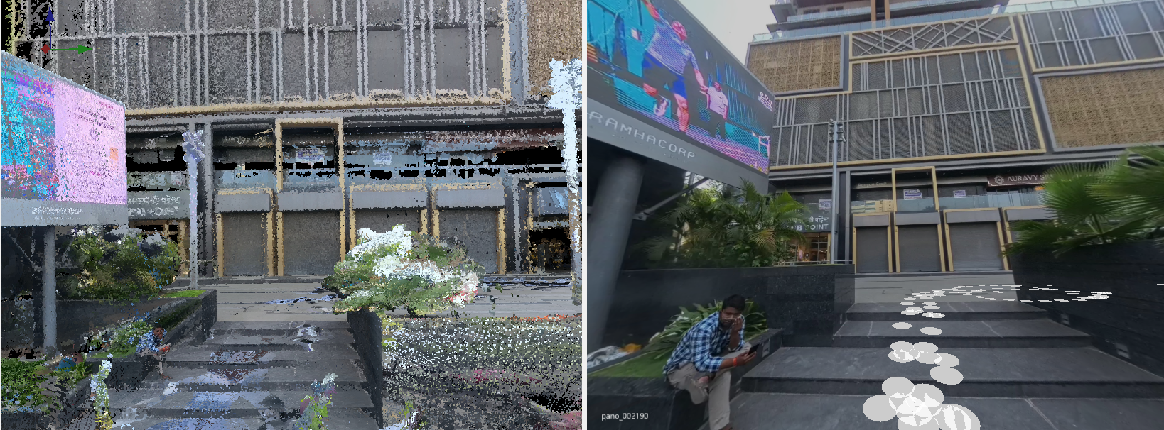
Sample Backpack LiDAR 3D point cloud data captured (left) with georeferenced Images (right)
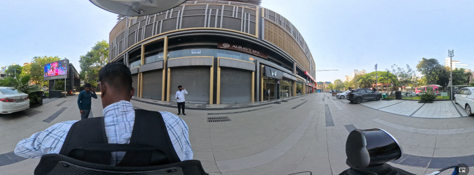
Sample 360 degrees panoramic HD Video
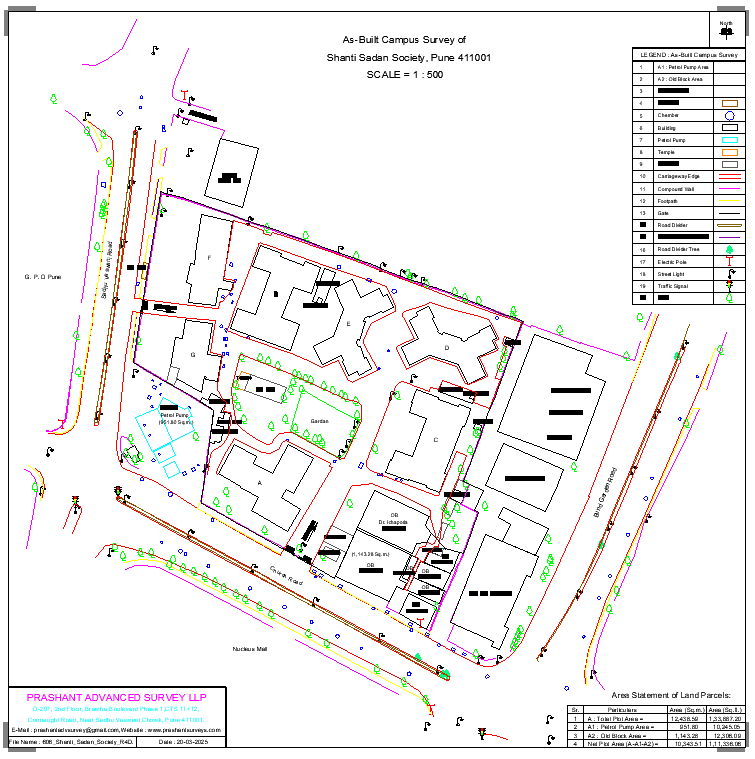
Vectorised AutoCAD *.dwg file
Initiative of Prashant Advanced Survey LLP for Backpack LiDAR surveys in India :
- 1st Company in India to own 3 numbers of Survey Grade Backpack LiDAR from Omniasphere – Janus Explore from Switzerland in 2024-25.
- 1st Land Surveying & Mapping company in India to adopt Backpack LiDAR survey technology exclusively for Architects, Builders, Landscapers, Valuers, BIM consultants & Property owners.
- Undertaken the work of 6 commercial Airports in India to prepare the 3D digital Maps of complete airports, using Mobile LiDAR and Backpack LiDAR technology.